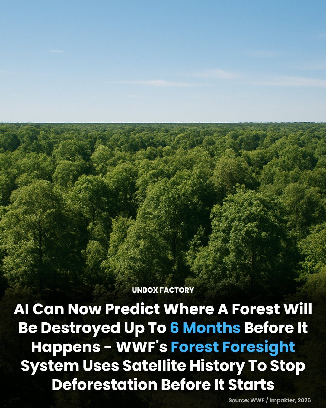
Forest Deforestation Prediction Using AI
Forest deforestation is a pressing global issue, with approximately 10 million hectares of forest lost annually. This destruction contributes significantly to biodiversity loss and climate change. Fortunately, advances in technology are providing new ways to combat this problem. The World Wildlife Fund (WWF) has developed an innovative solution: Forest Foresight, an AI-powered monitoring system capable of predicting where illegal deforestation is likely to occur up to six months in advance.
Why This Matters
Early warning systems like Forest Foresight are crucial for conservation efforts. By identifying areas at risk of deforestation before it happens, authorities and environmental organizations can take proactive measures to protect vulnerable forests. This proactive approach can dramatically improve the effectiveness of conservation efforts, helping to mitigate the impacts of deforestation on our environment and climate.
The Technology Behind Forest Foresight
AI and Satellite Imagery
Forest Foresight leverages the power of artificial intelligence and satellite imagery to predict deforestation hotspots. The system analyzes a vast amount of data, including satellite images, historical land-use patterns, road construction, and environmental data. By examining these details, the AI can identify patterns and indicators that suggest a high risk of deforestation.
Historical Land-Use Patterns
One of the key components of Forest Foresight is its analysis of historical land-use patterns. By understanding how land has been used in the past, the system can make more accurate predictions about future deforestation. This historical context is essential for identifying trends and pinpointing areas that are particularly vulnerable to illegal clearing.
Road Construction and Environmental Data
In addition to satellite imagery and historical land-use patterns, Forest Foresight also considers road construction and environmental data. Road construction can often lead to deforestation, as new roads provide access to previously untouched areas. By monitoring road construction, the system can anticipate where deforestation is likely to occur and alert authorities to intervene.
How Forest Foresight Works
Data Collection
The first step in the Forest Foresight process is data collection. The system gathers a wide range of data, including satellite imagery, historical land-use patterns, road construction data, and environmental data. This comprehensive approach ensures that the system has a complete picture of the areas it is monitoring.
Data Analysis
Once the data is collected, it is analyzed using advanced AI algorithms. The AI examines the data for patterns and indicators that suggest a high risk of deforestation. By identifying these patterns, the system can predict where illegal deforestation is likely to occur up to six months in advance.
Alert System
After the data is analyzed, the system generates alerts for areas at high risk of deforestation. These alerts are sent to authorities and environmental organizations, who can then take proactive measures to protect the vulnerable forests. The early-warning system allows for timely intervention, helping to prevent deforestation before it happens.
Practical Tips for Utilizing AI in Conservation
Integrate AI with Existing Systems
While AI can provide powerful insights, it is most effective when integrated with existing conservation systems. By combining AI predictions with on-the-ground monitoring and enforcement, authorities can create a more comprehensive approach to forest protection.
Collaborate with Local Communities
Local communities often have valuable knowledge about their surroundings and can play a crucial role in forest conservation. Collaboration with local communities can enhance the effectiveness of AI-driven conservation efforts, ensuring that interventions are well-received and sustainable.
Continuous Monitoring and Updates
Deforestation patterns and risks can change over time, so it is essential to continuously monitor and update AI systems. Regular updates to the data and algorithms can improve the accuracy of predictions, making the system even more effective in preventing deforestation.
Important Takeaways
Proactive Measures are Crucial
Proactive measures are key to effective forest conservation. By predicting where deforestation is likely to occur, authorities can take steps to protect vulnerable areas before illegal clearing begins. This proactive approach is more effective than reactive measures and can significantly reduce the impact of deforestation.
AI Enhances Conservation Efforts
AI-powered systems like Forest Foresight enhance conservation efforts by providing valuable insights and early warnings. By leveraging the power of AI, environmental organizations and authorities can make more informed decisions and take targeted actions to protect forests.
Data-Driven Decisions
Data-driven decisions are essential for effective forest conservation. By analyzing a wide range of data, including satellite imagery, historical land-use patterns, and environmental data, AI systems can provide a comprehensive view of the risks and trends in forest areas. This data-driven approach helps authorities make informed decisions and take effective actions to protect forests.
Conclusion
The World Wildlife Fund's Forest Foresight system represents a significant advancement in forest conservation. By leveraging AI and satellite imagery, the system can predict where deforestation is likely to occur up to six months in advance. This early-warning capability allows authorities to take proactive measures, protecting vulnerable forests and mitigating the impacts of deforestation on our environment and climate. As technology continues to evolve, AI-driven solutions like Forest Foresight will play an increasingly important role in global conservation efforts, helping to ensure a sustainable future for our planet.
Watch the Reel
Questions readers ask
How does WWF's Forest Foresight AI system predict deforestation hotspots?
The WWF's Forest Foresight AI system uses a combination of satellite imagery and historical data to identify patterns and trends that indicate where deforestation is likely to occur. By analyzing this information, the system can predict deforestation hotspots up to six months in advance.
What are the benefits of early deforestation warning systems like Forest Foresight?
Early warning systems like Forest Foresight help conservation efforts by allowing authorities and environmental organizations to take proactive measures. By identifying areas at risk, these systems enable timely interventions to prevent illegal deforestation and protect vulnerable ecosystems.
Can Forest Foresight detect illegal deforestation activities?
Yes, Forest Foresight is designed to detect areas at high risk of illegal deforestation. By predicting where these activities are likely to occur, the system helps authorities focus their resources and efforts more effectively to prevent and respond to illegal deforestation.
How does satellite imagery contribute to deforestation prediction?
Satellite imagery provides a bird's-eye view of forest areas, allowing the AI system to monitor changes over time. By analyzing these images, the system can detect patterns that indicate deforestation risks, such as road construction or logging activities, which are often precursors to large-scale deforestation.
What role does historical data play in Forest Foresight's predictions?
Historical data is crucial for training the AI system to recognize patterns and trends associated with deforestation. By learning from past events, the system can improve the accuracy of its predictions and better anticipate future deforestation hotspots.
What actions can authorities take based on Forest Foresight's predictions?
Based on Forest Foresight's predictions, authorities can deploy patrols to high-risk areas, enforce regulations more effectively, and collaborate with local communities to implement sustainable forest management practices. Additionally, environmental organizations can use this information to rally support and resources for conservation efforts.
Can Forest Foresight's technology be applied to other environmental issues?
While Forest Foresight is specifically designed for deforestation prediction, the underlying technology can be adapted for other environmental monitoring tasks. The AI and satellite imagery used in this system could potentially be applied to track other environmental changes, such as coastal erosion, water pollution, or wildlife habitat degradation.
Related deep dives
Similar reads based on topic and creator.



Recent articles
Fresh deep dives from the latest Reels we unpacked.

Comments
Be the first to comment.