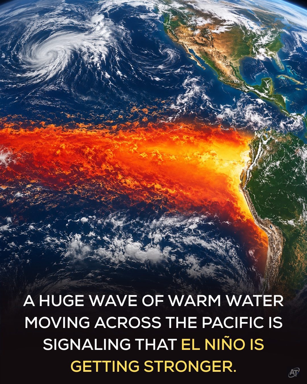
El Niño Phenomenon
El Niño, a complex weather pattern characterized by unusually warm ocean surface temperatures in the central and eastern equatorial Pacific, is officially underway. The current event has meteorologists and climate scientists closely monitoring its development, as forecasts suggest it could become one of the strongest El Niño events in decades.
Why This Matters
Understanding El Niño is crucial because it can significantly influence weather patterns worldwide. The event is part of the El Niño-Southern Oscillation (ENSO) cycle, which also includes La Niña, the cooler counterpart. El Niño's impacts can include shifting precipitation patterns, altering storm tracks, and influencing the frequency and intensity of heatwaves and droughts. These changes can have profound effects on agriculture, water resources, and ecosystems.
The Science Behind El Niño
The El Niño phenomenon is driven by a series of interconnected oceanic and atmospheric processes. Normally, the Pacific's strong easterly trade winds push warm surface water westward, allowing cooler water to upwell in the east. However, during an El Niño event, these trade winds weaken or even reverse. This allows the warm water to shift eastward, creating a deep layer of warm water that significantly alters the ocean and atmospheric conditions.
Development of the Current El Niño Event
In July, the National Oceanic and Atmospheric Administration (NOAA) reported a sharp rise in key ocean temperatures across the central and eastern equatorial Pacific. This warming was accompanied by changes in wind patterns and atmospheric pressure, confirming that the ocean and atmosphere were acting together to strengthen the El Niño event. A recent oceanic Kelvin wave, a large-scale oceanic wave that moves from west to east, has further deepened the warm-water layer and raised temperatures across the eastern Pacific.
Forecasts and Predictions
NOAA currently gives this El Niño event a 97% chance of continuing through early spring 2027. More notably, forecasters estimate an 81% chance that the El Niño event will reach "very strong" intensity during the October–December 2026 period. If this occurs, it could place this event among the largest El Niño events recorded since 1950.
Global Impacts of El Niño
El Niño's effects extend far beyond the Pacific and can reorganize atmospheric circulation patterns, shifting the odds of drought, heavy rainfall, heatwaves, and altered storm tracks in different parts of the world. Its exact impacts will vary by location, and even a very strong event does not guarantee extreme weather everywhere. However, the current El Niño event is particularly concerning because it is developing on top of long-term human-caused global warming. This means that El Niño can temporarily raise global temperatures, adding heat and moisture to an atmosphere and ocean that are already unusually warm.
Practical Tips for Coping with El Niño
Given the potential impacts of a strong El Niño event, it's essential to stay informed and prepared. Here are some practical tips to help you navigate through this weather phenomenon:
Stay Informed
Regularly check updates from reputable meteorological agencies, such as NOAA, to stay informed about the latest developments and forecasts related to El Niño. Being aware of the potential impacts in your area can help you prepare and plan accordingly.
Prepare Your Home
Depending on your location, you may need to prepare for increased rainfall, drought, or heatwaves. Take steps to secure your property, such as cleaning gutters, reinforcing structures, and ensuring your home is well-insulated.
Plan Your Agriculture
Farmers and gardeners should be prepared for potential changes in precipitation and temperature patterns. This may involve adjusting planting schedules, implementing drought-resistant crops, or investing in irrigation systems.
Monitor Water Resources
With altered precipitation patterns, water resources may be affected. Stay aware of local water conservation guidelines and be prepared to adapt to potential water shortages or flooding.
Important Takeaways
Understanding the El Niño phenomenon, particularly the current event, is crucial for both individuals and communities. Its impact on global weather patterns and the potential for extreme weather events underscores the importance of staying informed and prepared. While NOAA and other meteorological agencies are closely monitoring its development, individuals can also take proactive steps to mitigate the potential impacts.
Conclusion
El Niño is a natural climate cycle with far-reaching effects on weather patterns worldwide. The current event, with its potential to reach "very strong" intensity, requires vigilance and preparedness. By staying informed, taking proactive measures, and adapting to changing conditions, individuals and communities can better navigate the challenges posed by this significant weather phenomenon.
Watch the Reel
Questions readers ask
What exactly is El Niño and how does it form?
El Niño is a weather pattern characterized by unusually high ocean surface temperatures in the central and eastern equatorial Pacific. It forms due to changes in atmospheric conditions, including shifts in surface winds, which can lead to a reversal of the typical ocean currents and a buildup of warm water in the eastern Pacific.
How does El Niño impact global weather patterns?
El Niño can significantly alter global weather by shifting precipitation patterns, changing storm tracks, and influencing the frequency and intensity of heatwaves and droughts. These impacts can vary by region, with some areas experiencing increased rainfall while others face drought conditions.
What is the ENSO cycle and how does El Niño fit into it?
The ENSO (El Niño-Southern Oscillation) cycle is a recurring climate pattern involving fluctuations in ocean temperatures and atmospheric conditions in the Pacific. El Niño is one phase of this cycle, marked by warmer-than-average ocean temperatures, while the other phase, La Niña, is characterized by cooler temperatures.
Why is the current El Niño event considered potentially historic?
The current El Niño event is being closely monitored because forecasts suggest it could become one of the strongest in recent decades. This strength implies that its impacts on global weather patterns, such as rainfall patterns and the intensity of heatwaves, could be more pronounced and widespread.
How can I stay updated on the latest developments of this El Niño event?
To stay informed about the latest developments, you can follow updates from reputable sources such as the National Oceanic and Atmospheric Administration (NOAA). NOAA provides regular updates on El Niño conditions, including sea surface temperatures and atmospheric changes, which can help you understand the potential impacts on weather and climate.
Related deep dives
Similar reads based on topic and creator.


Recent articles
Fresh deep dives from the latest Reels we unpacked.




Comments
Be the first to comment.