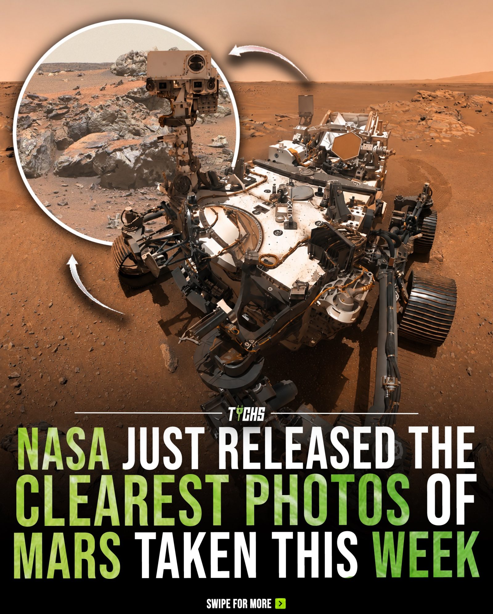
Mars Rover Photos: Exploring the Red Planet in Unprecedented Detail
NASA’s latest images from the Perseverance rover are offering unprecedented views of Mars, revealing extraordinary detail across the Red Planet’s ancient landscape.
Why This Matters
These newly released photographs provide more than just stunning visuals; they offer scientists valuable clues about Mars’ geological history and its potential to support microbial life. Each image, captured by Perseverance’s advanced camera system, helps reconstruct the planet’s evolution over billions of years. This information is crucial for planning future exploration and the ongoing search for signs of ancient life.
Main Discussion
The Perseverance Rover and Its Mission
Launched in July 2020, the Perseverance rover is part of NASA’s Mars 2020 mission. It is designed to explore the Jezero crater, an ancient lake bed that scientists believe could have once supported life. The rover is equipped with a suite of advanced scientific instruments, including cameras, spectrometers, and even a small helicopter named Ingenuity for aerial reconnaissance.
High-Resolution Images of Mars
The newly released photographs showcase layered rock formations, wind-shaped terrain, and fine surface features. These images are not only visually stunning but also provide valuable geological data. The high-resolution images allow scientists to study the Martian surface in remarkable detail, offering insights into the planet’s past.
Layered Rock Formations
One of the most intriguing features captured in these images is the layered rock formations. These layers, visible in the cliffs and outcrops, tell a story of Mars’ geological history. Each layer represents a different period in the planet’s past, recording changes in climate, water activity, and geological processes.
Wind-Shape Terrain
The wind-shaped terrain, or aeolian features, provides clues about Mars’ current and past weather patterns. The wind erodes and shapes the Martian landscape, creating dunes, ripples, and other features. By studying these features, scientists can understand the dynamics of Martian winds and their role in shaping the planet’s surface.
Fine Surface Features
The advanced camera system on Perseverance captures fine surface features, such as small rocks, pebbles, and even grains of sand. These details are crucial for understanding the planet’s mineral composition and the processes that formed these features. This information helps scientists reconstruct Mars’ geological history and identify potential sites for further exploration.
The Role of Perseverance in Future Exploration
Perseverance’s mission is just the beginning of a series of planned explorations. The rover is collecting samples of Martian rocks and soil, which will be returned to Earth by future missions. These samples will provide scientists with the opportunity to study Mars in unprecedented detail, search for signs of ancient life, and prepare for human exploration.
The Ongoing Search for Signs of Ancient Life
One of the primary goals of the Perseverance mission is to search for signs of ancient life. The rover is equipped with instruments designed to detect organic molecules and other biosignatures. The high-resolution images, combined with data from other instruments, help scientists identify potential sites where life could have once existed.
Practical Tips for Viewing and Understanding Mars Images
Using Online Tools to Explore Mars
NASA provides a wealth of tools and resources for exploring Mars images. The NASA Mars Exploration Program website offers interactive maps, 3D images, and detailed descriptions of the Martian terrain. These tools allow anyone to explore the Red Planet from the comfort of their home.
Interactive Maps
Interactive maps, such as the one provided on the NASA Mars Exploration Program website, allow viewers to zoom in on specific areas of interest. These maps feature high-resolution images, along with labels and annotations that provide context and additional information.
3D Images
NASA also offers 3D images of the Martian surface. These images can be viewed using a variety of 3D viewing tools, including stereoscopic glasses and virtual reality headsets. This immersive experience brings the Martian landscape to life, allowing viewers to explore the planet as if they were there.
Important Takeaways
The newly released images from the Perseverance rover are a testament to the power of space exploration. They provide valuable insights into Mars’ geological history and the potential for ancient life. With each new discovery, Perseverance is helping transform Mars from a distant mystery into a world we can study in remarkable detail. These images are not only visually stunning but also play a vital role in planning future exploration and the ongoing search for signs of ancient life.
Conclusion
The clearest views of Mars ever captured by the Perseverance rover are more than just a feast for the eyes; they are a treasure trove of scientific data. From layered rock formations to wind-shaped terrain, each image tells a story about the Red Planet’s past and future. As we continue to explore Mars, these high-resolution images will guide our path, helping us unravel the mysteries of our neighboring planet and pave the way for future missions.
Watch the Reel
Questions readers ask
What makes the new images from the Perseverance rover unique?
The new images from the Perseverance rover are unique due to their high resolution, which offers vivid and detailed views of Mars' surface. These images capture geological features such as layered rocks and wind-carved terrain, providing a level of detail not seen before.
How do these images contribute to our understanding of Mars?
These images contribute to our understanding of Mars by providing clues about the planet's geological history and its potential to support microbial life in the past. They help scientists reconstruct Mars' evolution over billions of years, aiding in the planning of future exploration missions.
What kind of camera system does the Perseverance rover use to capture these images?
The Perseverance rover uses an advanced camera system designed to capture high-resolution images. This system includes multiple cameras with different lenses and capabilities, allowing for detailed and comprehensive documentation of the Martian landscape.
What are some of the geological features visible in the new Perseverance rover photos?
The new photos from the Perseverance rover reveal various geological features, including layered rocks that offer insights into Mars' past environments and wind-carved terrain that illustrates the planet's dynamic surface processes over time.
Why is it important to study the ancient surface of Mars?
Studying the ancient surface of Mars is important because it provides a record of the planet's past conditions and potential for habitability. By analyzing the surface features and compositions, scientists can determine if Mars once had environments suitable for microbial life, which could inform future exploration and research efforts.
How do these images support future missions to Mars?
These images support future missions by providing detailed information about the Martian terrain, helping mission planners choose landing sites and plan routes. They also offer crucial insights into the planet’s geological history, aiding in the search for signs of ancient life and guiding the design of future exploration strategies.
What is the Perseverance rover's primary mission?
The Perseverance rover's primary mission is to search for signs of ancient microbial life on Mars and to collect samples for future return to Earth. It also tests new technologies for future human exploration and investigates the planet's geological processes, climate and weather patterns.
Related deep dives
Similar reads based on topic and creator.

Recent articles
Fresh deep dives from the latest Reels we unpacked.




Comments
Be the first to comment.