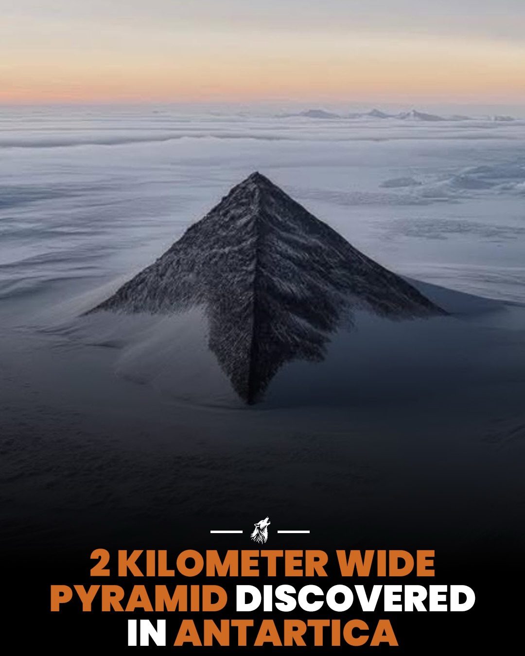
The pyramid-shaped peaks in Antarctica have garnered significant attention, particularly a notable structure in the Heritage Range of the southern Ellsworth Mountains. This unnamed peak is roughly 1,265 meters tall and approximately two kilometers across at the base. Geologists have long understood the nature of these formations, classifying them as nunataks—a term derived from Inuit, meaning a rock summit protruding above an ice sheet.
Context / Why this matters
The misconception about these peaks being man-made structures often arises from a phenomenon known as pareidolia, where the brain perceives familiar patterns in random stimuli. In this case, the pyramid-like shape of these peaks, combined with their remote and mysterious location, have fueled speculation and conspiracy theories.
Understanding the geological processes that form these peaks is crucial for several reasons. Firstly, it helps dispel myths and misinformation that can lead to unnecessary panic or unwarranted expeditions. Secondly, it sheds light on the geological history of Antarctica, providing insights into the continent's past and its potential future changes due to climate shifts.
Main discussion
Geological origins
The pyramidal peaks in Antarctica, including the one in the Heritage Range, are not man-made but natural geological formations. They are classified as nunataks, which are rock summits that protrude above glacial ice. Nunataks form through a combination of glacial erosion and tectonic processes.
The specific shape of these peaks—termed glacial horns or pyramidal peaks—results from the erosion of a mountain by separate glaciers grinding into it from multiple sides. This process carves steep faces that meet at a point, creating the distinctive pyramid-like appearance.
Formation process
The formation of these pyramidal peaks is a slow but relentless process. It begins with the erosion of a mountain by multiple glaciers. These glaciers grind into the mountain from different directions, carving out steep faces. Over time, freeze-thaw erosion further refines the shape. Water seeps into fractures, freezes overnight, and expands, prying away chunks of rock over hundreds of millions of years. This process continues until the peak achieves its distinctive pyramidal shape.
Comparison with other peaks
The process that forms these Antarctic peaks is similar to how other famous peaks around the world were created. For example, the Matterhorn in Switzerland and Alpamayo in Peru are both glacial horns. These mountains are not subject to the same level of scrutiny or speculation as the Antarctic peaks, largely due to their accessibility and the absence of mysterious imagery.
Historical context
Geologists have known about the true nature of these peaks for a long time. The pyramids have been studied extensively, and their geological origins are well-documented. The confusion often stems from the misinterpretation of satellite images, which can be misleading if viewed without proper context.
Scientific explanations
Dr. Mitch Darcy of the German Research Centre for Geosciences explains that by definition, a nunatak is simply a peak of rock jutting out above an ice sheet. This natural formation process is well-understood, although it is often shrouded in mystery by those unfamiliar with geology.
Environmental science professor Mauri Pelto noted that the symmetry of this particular Antarctic peak is due to the roughly matching erosion rates on its three sides. This symmetry, combined with the remote and icy location, contributes to the peak's intriguing appearance.
Practical tips
For those interested in understanding the true nature of these peaks, here are some practical tips:
Learn the basics of glacial erosion
Understanding the basics of glacial erosion can help demystify the formation of these peaks. Glaciers move and erode the landscape over time, carving out valleys and shaping mountains.
Study geological terms
Familiarize yourself with geological terms such as nunatak and glacial horn. These terms provide a clear understanding of the natural processes that shape our planet.
Examine satellite imagery critically
Satellite imagery can be misleading if viewed without proper context. Always look for scientific explanations and studies that support or refute claims about mysterious geological formations.
Important takeaways
The pyramidal peaks in Antarctica are natural geological formations, not man-made structures. Understanding the geological processes that create these peaks is essential for dispelling myths and misinformation. The peaks are classified as nunataks and are formed through a combination of glacial erosion and tectonic processes. The process that creates these peaks is similar to how other famous peaks, such as the Matterhorn and Alpamayo, were formed. Geologists have long understood the true nature of these peaks, and their formation is well-documented in scientific literature.
Conclusion
The pyramid-shaped peaks in Antarctica, particularly the one in the Heritage Range, are a fascinating example of natural geological processes. By understanding the science behind these formations, we can appreciate their beauty and mystery without resorting to speculation or myth. These peaks serve as a reminder of the powerful forces that shape our planet and the importance of scientific inquiry in understanding the natural world.
Watch the Reel
Questions readers ask
What are nunataks and how do they form?
Nunataks are isolated peaks or mountains that protrude above an ice sheet. They are formed from tectonic processes and glacial erosion over millions of years, and are not man-made structures. The formation of nunataks involves the gradual wearing away of surrounding landscape which leaves the peaks standing alone.
Why do some people believe the pyramid-like peaks in Antarctica are man-made?
This misconception is largely due to pareidolia, a phenomenon where the brain perceives familiar patterns in random stimuli. The distinctive shape and remote location of these peaks can lead people to see them as artificial structures, despite their natural geological origins. In the case of Antarctica, this has led to much speculation and conspiracy theories.
What is the Heritage Range and is the pyramid peak there natural?
The Heritage Range is a mountain range located in the southern Ellsworth Mountains, Antarctica. The pyramid-like peak in this range is a nunatak, a natural geological feature, and is not man-made. This peak is approximately 1,265 meters tall and about two kilometers across at its base.
How do glacial processes contribute to the formation of nunataks?
Glacial erosion plays a significant role in the formation of nunataks. As glaciers move, they erode the surrounding landscape, gradually wearing away the softer materials and leaving behind more resistant rock formations. Over time, this process can create the distinctive, isolated peaks known as nunataks.
Are there other examples of wide, pyramid-shaped peaks in Antarctica?
Yes, there are several nunataks in Antarctica that exhibit a wide, pyramid-shaped form. These peaks can measure thousands of meters across and hundreds of meters tall. Examples of such formations include nunataks in the Ellsworth, Pensacola, and Thiel Mountains.
How do scientists study and document the geological features of Antarctica?
Scientists study and document the geological features of Antarctica through extensive field research, satellite imagery, and geophysical surveys. Field researchers collect rock samples and map the terrain, while satellite imagery and geophysical surveys help to create detailed maps and models of the landscape. This information is used to understand the geological processes that shape Antarctica.
Why is it important to understand the geological features of Antarctica?
Understanding the geological features of Antarctica is crucial for several reasons. It provides insights into the continent's history and the processes that have shaped it. This knowledge helps scientists to better understand geological processes on a global scale, and can provide clues about climate change and the dynamics of the Earth's crust and ice sheets.
Related deep dives
Similar reads based on topic and creator.




Recent articles
Fresh deep dives from the latest Reels we unpacked.




Comments
Be the first to comment.