AI Tools for 3D Map Creation
Google Maps is already an indispensable tool for navigating the world, but what if you could transform a simple URL into an immersive 3D experience? Recent advancements in AI have made this possible.
Importance of 3D Mapping
3D mapping has revolutionized how we interact with geographical data. It goes beyond static 2D images, offering a dynamic, immersive view of locations. This technology has applications in urban planning, real estate, tourism, and more. It provides a better understanding of spatial relationships, which is crucial for decision-making in these fields.
AI Tools for 3D Mapping
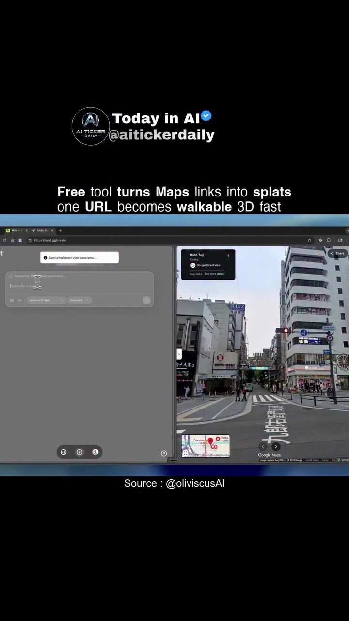
One of the standout developments in this field is the AI-driven transformation of Google Maps links into walkable 3D models. This technology leverages Google Street View data and uses Gaussian splatting to create a more detailed and realistic 3D environment. The result is an immersive 3D experience that you can explore interactively.
How the Tool Works
The process is surprisingly straightforward. Users simply input a Google Maps URL into the online tool. The AI then generates a fully 3D Gaussian splat, which is a type of 3D rendering that creates a smooth, continuous surface from points in space. This splat can be explored from various angles, providing a more comprehensive view of the location. The tool showcased various locations, including Tokyo, Rome, and Florence. This highlights the technology's versatility in handling different types of urban and natural landscapes.
Practical Tips for Using the Tool
To get the most out of this tool, follow these practical tips:
Start with High-Quality URLs
The quality of the 3D model depends significantly on the quality of the Google Maps URL. Ensure that the URL points to a well-defined location with good coverage in Google Street View. This will provide the AI with better data to work with, resulting in a more accurate and detailed 3D model.
Explore Different Angles
Once the 3D model is generated, explore it from different angles. This will give you a better understanding of the spatial relationships and the overall layout of the location. The interactive nature of the model allows for a more immersive experience, making it easier to visualize the area.
Use for Various Applications
Whether you're in urban planning, architecture, real estate, or tourism, this tool can greatly enhance your work. For instance, urban planners can use it to visualize potential developments, architects can explore sites before construction, and real estate agents can provide virtual tours. Tourists can also benefit from this tool, getting a better sense of their destinations before they arrive.
Share Your Discoveries
One of the best features of this tool is the ability to share your 3D explorations. This can be incredibly useful for collaboration, especially in fields like urban planning and architecture. You can share the 3D model with colleagues, clients, or stakeholders to get their input and feedback.
Important Takeaways
The ability to transform Google Maps URLs into immersive 3D experiences marks a significant leap in geographical data visualization. This tool simplifies the process of creating 3D representations, making it accessible to a broader audience. It has a wide range of practical applications, from urban planning to real estate and tourism, offering a more comprehensive and interactive way to explore and understand geographical data.
Conclusion
The future of geographical data visualization is here, and it's in 3D. AI tools that convert Google Maps links into walkable 3D models are making this technology more accessible and user-friendly. Whether you're a professional in urban planning, architecture, real estate, or tourism, or simply someone who loves exploring new places, this tool offers an immersive and interactive way to engage with geographical data.
Watch the Reel
Questions readers ask
How does the AI tool convert Google Maps links into 3D models?
The AI tool uses advanced algorithms to analyze the data from Google Maps URLs. It then generates detailed 3D models that can be explored interactively, providing a lifelike experience of urban and natural landscapes.
Which cities can I explore using this 3D mapping tool?
The tool allows you to explore a variety of cities, including Tokyo, Rome, and Florence. You can immerse yourself in the intricate details of these locations, from bustling city streets to serene natural landscapes.
What are the benefits of using 3D maps over traditional 2D maps?
3D maps offer a more dynamic and immersive experience compared to 2D maps. They provide a better understanding of spatial relationships, which is beneficial for urban planning, real estate, and tourism. This enhanced view can aid in decision-making processes by offering a more accurate representation of the environment.
Can I use this tool for professional purposes, such as real estate or urban planning?
Yes, the 3D mapping tool is highly useful for professionals in real estate and urban planning. It allows for a detailed examination of properties and landscapes, which can help in making informed decisions. The immersive 3D models provide a clearer picture of the environment, aiding in better planning and development strategies.
How can I access and use the 3D mapping tool?
To use the tool, you simply need to input a Google Maps URL. The AI technology will then process this data and generate a 3D model that you can explore in real time. The process is user-friendly and requires no specialized knowledge, making it accessible for a wide range of users.
What kinds of landscapes can I explore with this 3D mapping tool?
This 3D mapping tool allows you to explore a wide range of landscapes, from urban environments like Tokyo and Rome to natural landscapes. You can get a detailed, interactive view of both man-made structures and natural settings, making it a versatile tool for various applications.
Is the 3D mapping tool compatible with all devices?
The 3D mapping tool is designed to be compatible with most modern devices. However, for the best experience, it is recommended to use a device with a reliable internet connection and sufficient processing power to handle 3D graphics. This ensures smooth navigation and detailed exploration of the 3D models.
Related deep dives
Similar reads based on topic and creator.



Recent articles
Fresh deep dives from the latest Reels we unpacked.



Comments
Be the first to comment.