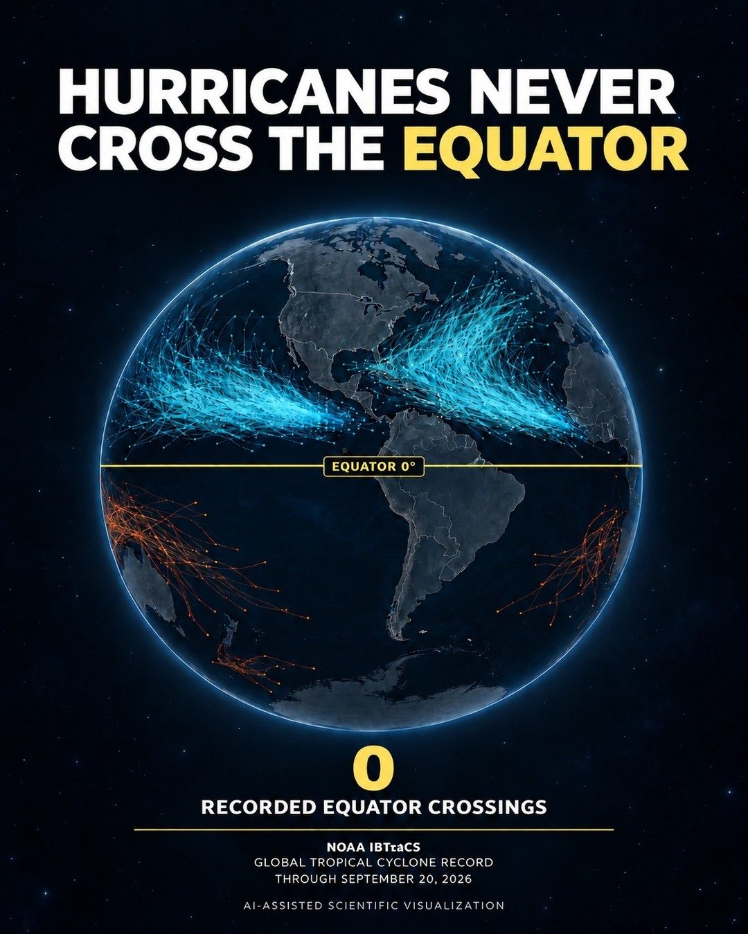
The Equatorial Barrier
Hurricanes possess a peculiar-Earth has a barrier largely ignored in popular meteorology discussions — that these storms cannot cross. This isn't due to the equator's magical properties rather, it's a matter of atmospheric dynamics. Near the equator, winds from the Coriolis force, which drives storms' rotation, grow too weak to sustain a hurricane's structure. The on-screen visualization depicts this phenomenon clearly: hurricanes originate and travel along paths that originate from various global locations, but never intersect at the equator, instead curving off as they approach. This isn't a cartographical quirk, but the real-world manifestation of a fundamental meteorological rule.
AI and data
The graphic showcases NOAA's IBTrACS data stretching over many decades, covering global tropical cyclone activity up until September 20, 2026. This is more than just meteorological data visualization. The AI may be able to pick up on subtle patterns that human analysts might miss. The AI's role in this visualization is particularly interesting it doesn't just present the data; it can potentially uncover insights that might otherwise go unnoticed. Yet, the AI's role is an appendix — the data itself is the star of the show. The power of AI in this visualization is not in its ability to create fancy graphics, but in its capability to process vast amounts of complex data. The AI can handle the NOAA IBTrACS data, which includes details on every recorded tropical cyclone since 1842. This is a magnitude of data that would be impossible for a human to process manually, yet the AI can handle it with relative ease.
Watch the Reel
Related deep dives
Similar reads based on topic and creator.

Recent articles
Fresh deep dives from the latest Reels we unpacked.


Comments
Be the first to comment.