Typhoon Saudel's Deadly Legacy
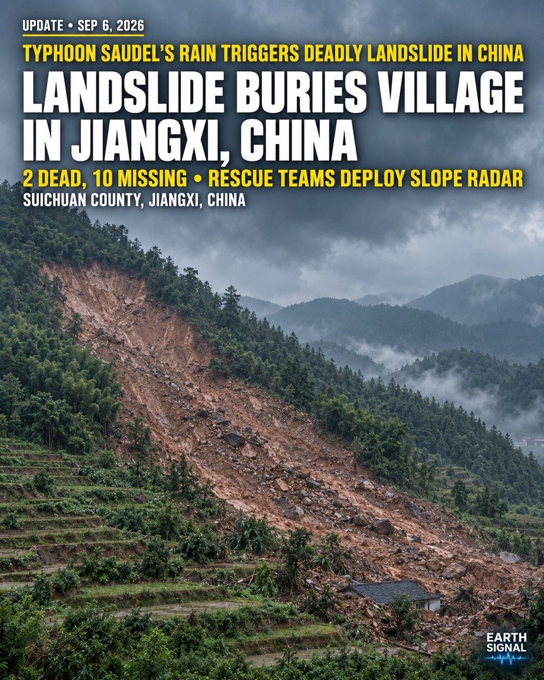
A mother of two is buried among the ruins of her home, etched deep into a mountainside. Desperate relatives and rescue personnel press forward in vain. Typhoon Saudel washed through China’s province of Jiangxi, depositing an avalanche of wet tonnes near the county of Suichuan in September this year. The deadly event buried entire villages under cascading mud and rock. The tragic consequences have left two dead and ten more, missing. A primary goal of the rescue mission is identifying the locations of those missing. A team outfitted with slope radar technology scours the affected area, systematically searching for signs of life. This tool helps map high-risk areas affected by landslides and pinpoint the locations of inhabitants.
Typhoon Saudel: Devastation at a Glance
Typhoon Saudel brought intense rainfall to China’s southern and central regions in early September, 2026. This event triggered landslides in the mountainous terrain of Jiangxi. Landslides can occur due to a range of factors—such as heavy rainfall, earthquakes, or human activities. Yet, heavy rainfall is the most common trigger. As a typhoon, Saudel bore torrential showers, saturating the ground and destabilizing the mountain slopes. The excess water seeped into the earth, weakening the slope’s structural integrity. As a result, the once stable ground gives way. The consequences can be devastating—especially in areas with densely populated locales. Landslides pose a significant hazard to the area's population. They are especially dangerous for villages nestled within steep mountain slopes. The relentless rainfall from Typhoon Saudel saturated the soil, leading to a catastrophic landslide that buried an entire village, trapping and killing residents. The landslide's devastating power underscored the need for vigilant monitoring and early warning measures. In a country with a long history of landslides, experts warn that the frequency and severity of these events may increase as climate change brings heavier rainfall.
The Role of Slope Radar in Landslide Rescue Operations
Rescue teams often face significant challenges in navigating and locating survivors in a landslide. These events have the potential to displace massive amounts of earth, often during inclement weather. Displaced soil and rock can obscure and bury existing landmarks. In these conditions, rescuers must rely on specialized equipment to locate survivors. Slope radar plays a crucial role in locating survivors by providing detailed imagery of subterranean conditions. It is essential for rescue teams working through mountains. It can map out areas impacted by soil shifts and pinpoint locations where survivors may be trapped. Due to its ability to penetrate various surface materials, slope radar can detect underground structures damaged by the landslide, allowing rescuers to focus their efforts.
Moving Forward: Mitigation and Preparedness
Landslides are more than just natural disasters; they are warnings. The need for improved disaster response systems is paramount. Large scale landslides can be deadly and render recovery personnel unable to reach the affected area. In response to the deadly landslide that devastated the Jiangxi region, China has increasingly invested in advanced mitigation and rescue technologies. Moving forward, the implementation of slope radar technology, along with other geotechnology tools such as InSAR for monitoring and satellite-based landslide mapping, could offer significant enhancements. In the wake of Typhoon Saudel, China saw the need for early warning systems, improved emergency response, and stronger infrastructure.
Watch the Reel
Related deep dives
Similar reads based on topic and creator.


Recent articles
Fresh deep dives from the latest Reels we unpacked.




Comments
Be the first to comment.